We Survived the Loneliest Road in America

The Loneliest Road in America in 4 Days
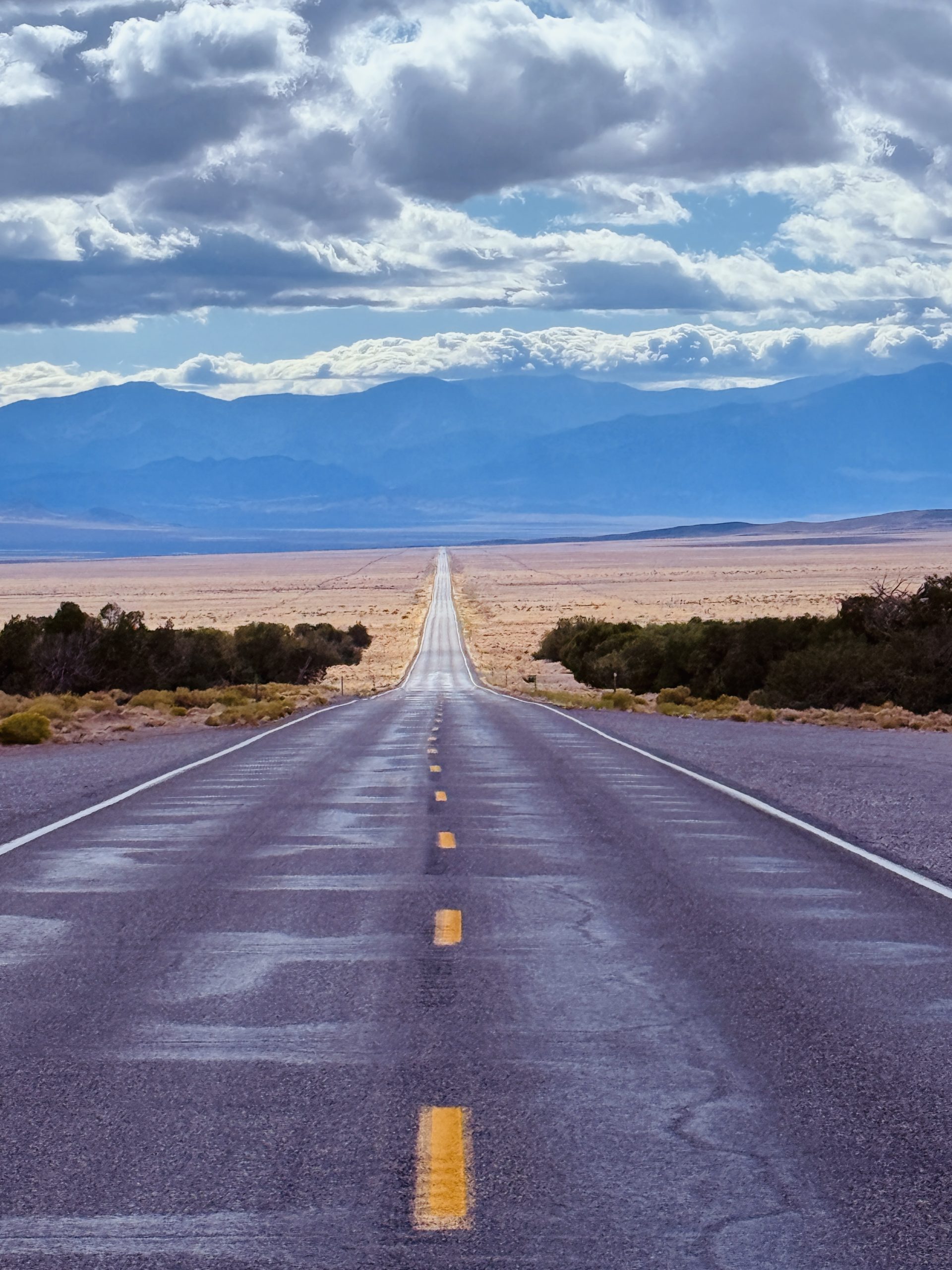
Garrett suggested driving the Loneliest Road in America to get to Great Basin National Park. I looked at the map, looked at him, and said — sure, why not? Life Magazine once warned motorists not to attempt it “unless they’re confident of their survival skills.” We figured two kids and a camper van was confidence enough.
Getting There and How
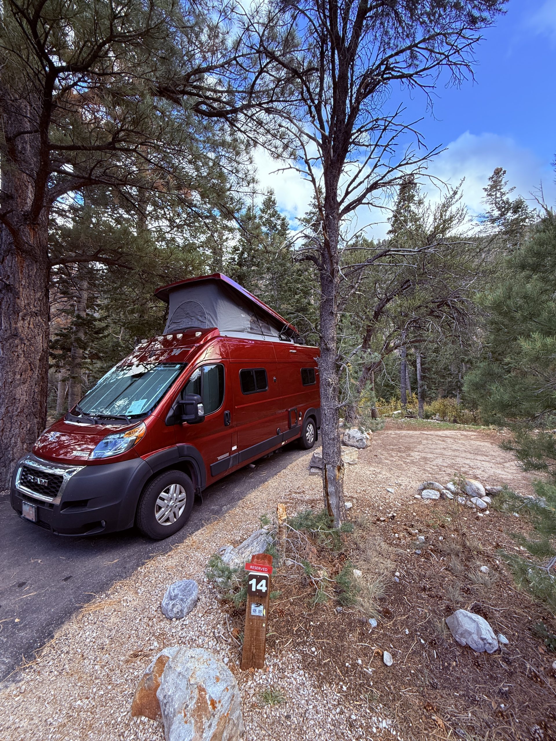
The Loneliest Road in America spans between Carson City and Great Basin National Park. After looking at what we could do along the way, we decided to relive our previous “van life” by renting another 19’ camper van from Outdoorsy. We love this size because you can still take some of those windy roads a larger RV can’t, plus we spend a decent amount of time outside anyway. You could easily drive a normal car, too, but there aren’t a ton of hotel options along the way, which is what influenced us.
You can either fly into Reno, or like we did, fly into Salt Lake City. Flying out of our little regional airport, Salt Lake City ended up being cheaper, plus we had more options for a camper van rental. All in all, we made a loop from SLC to Great Basin, along Hwy 50 to Lake Tahoe and then up north to I-80 to hit the Bonneville Salt Flats on our way back. If you’re starting in Reno, just reverse the trip.
When to Go
We chose to over the kids’ fall break in October. This has its pros and cons. First, things were not busy, so it truly felt like the Loneliest Road along many stretches. We spent time at Great Basin without running into people, drove along empty roads, and had the beach to ourselves at Lake Tahoe. On the other hand, there were a lot of places along the way that were already in their winter hours so we missed out on a few things we wanted to do and it was a bit chilly. If possible, I think September would be a great option.
Things to Know
- There is little to no cell service throughout the park and along the highway (although more than expected!). Download your offline maps before you leave more populated areas.
- There aren’t a ton of services along the way. Fill your water bottle and gas tank whenever you can, just in case. Have some snacks and a spare tire too!
- SUNSCREEN
- A hat to keep the sun off of you and sunglasses are super helpful.
- Know your limits
- Leave no trace and more importantly, leave it better than how you found it!
With that being said, grab your Survival Guide and let’s head out!
Day 1 on The Loneliest Road – Great Basin National Park
Grab your first stamp in Baker, Nevada, before heading into Great Basin National Park. One day can give you the highlights, but feel free to add more on if you’d like.
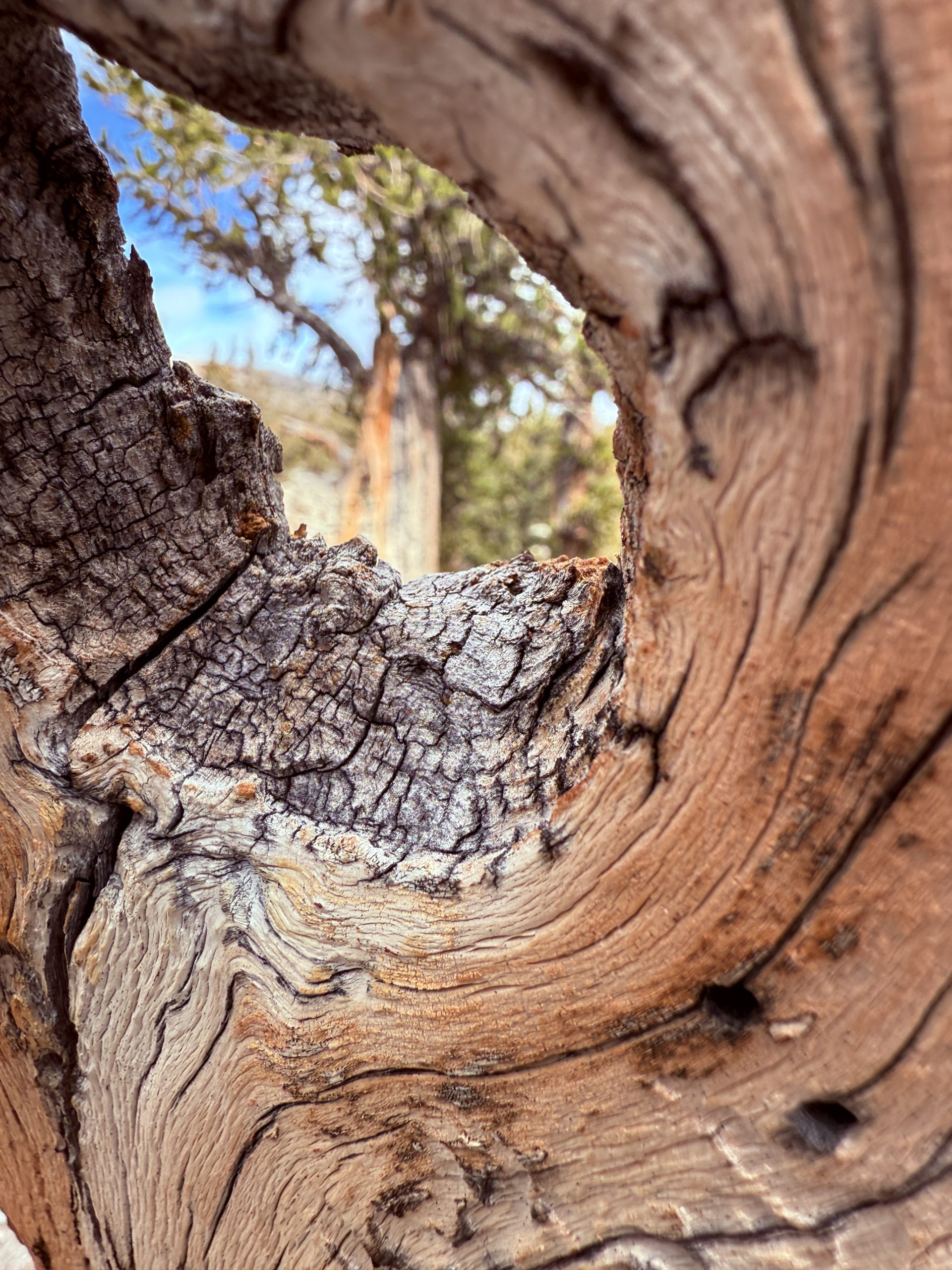
I could make an entire post about this national park (oh wait, I did!), but make sure to see Lehman Cave and some Bristlecone Pines. This might be your once in a lifetime chance.
Total Time with travel: 5 hours
Day 2 on The Loneliest Road – Great Basin to Ely
Head out early along Highway 50 towards Ely.
- Along the way, stop at Ward Charcoal Ovens State Historic Park. $10 per car gets you in to see charcoal ovens the size of houses.
- Make reservations for a train ride at the Nevada Northern Railway (ours was at 9:30 AM). After the ride, hop off the train for the machine shop tour. This was an unexpected delight! The kids said that tour was their favorite part. Snap a picture with Artie before walking to the museum and gift shop. Grab your stamp here.
- Lunch was at Economy Drug, an old-time pharmacy with a soda fountain, milkshakes, and delicious sandwiches.
- We drove around town looking at the murals and Hotel Nevada. There’s a walking tour, but the kids were not having it.
- Grab some pizza from Hometown Pizza for dinner later.
- Snap your picture at the Highway 50 “Loneliest Road in America” sign outside of town just west of 1st street on your way out to
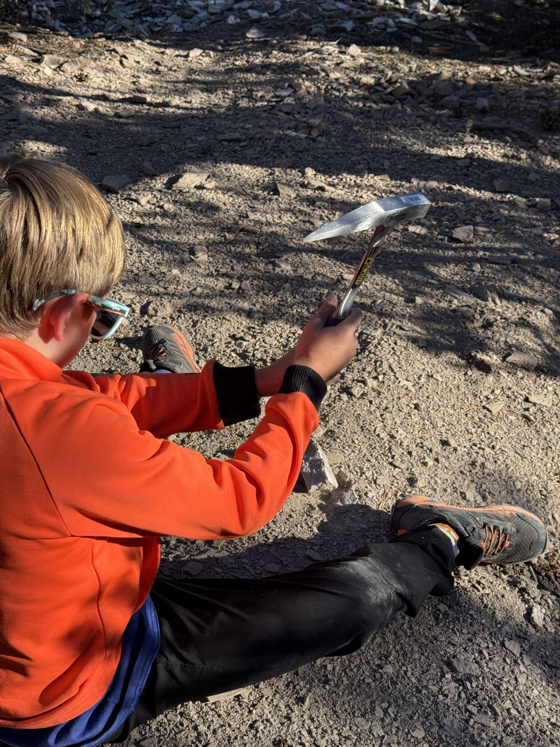
- Garnet Hill. Walk out from the parking area and look for pink rhyolite with lines of quartz. If you find vugs, or little holes where the garnets form, you’re on the right path. As time goes on, the garnets are eroded from these cavities, so you can find them sometimes in the drainages, but we had the best luck breaking rocks open. Make sure you have a rock hammer/pick, shovel, safety goggles or sunglasses, and gloves.
- Boondock – since Garnet Hill is BLM land, we took the opportunity to boondock just down the road from the parking area. We watched the beautiful sunset as the kids discovered a few more garnets.
Total Time with travel: 5 hours 30 minutes
Day 3 on The Loneliest Road – Ely to Eureka to Austin
Aim to hit Eureka just before lunch time. Eureka, dubbed “The Friendliest Town on the Loneliest Road”, lives up to its nickname! Everyone we talked to were so nice.
- Explore the Eureka Opera House. When we stopped by, they were setting up for a show, but we were able to go backstage and down to the dressing rooms.
- Stop by the post office next door for a reliable place to grab the stamp.
- Across the street is the Eureka Courthouse and Eureka Sentinel Museum, both of which are on the walking tour.
- Grab lunch at the Urban Cowboy. We had planned on eating somewhere else, but it was closed. As we walked along main street looking at restaurant times, a gentleman was standing outside of a convenience store next to the Urban Cowboy. He asked if we were looking for lunch and promptly led us through the employee door between the two where we were sat down with a warm greeting. And let me tell you, the Indian food was absolutely mouthwatering! The kids enjoyed tasty chicken fried steak and mozzarella cheese sticks that definitely held their own, but the chicken biryani and chicken korma curry were to die for. I would go back just for the Urban Cowboy.
- After lunch, we continued west with a stop at Hickison Petroglyph Recreation Area to see some well-preserved petroglyphs along a 1.6-mile trail. There’s a campground with toilets here if you’re looking for a developed place to stay.
- Now, this is what I was talking about places following winter hours. We intended on stopping at Little Blue Bird Turquoise and Jason’s Art Gallery in Austin, but we found out they are only open Thursday through Saturday in the winter, so we missed them.
- The nice lady at the Austin gas station stamped our survival guide after she called the owners of the Little Blue Bird Turquoise to find out the hours.
- Another place to consider is the Lucky Spur Saloon. It’s closed Mondays and Tuesdays, so again, we missed it, but it looks like a fun spot.
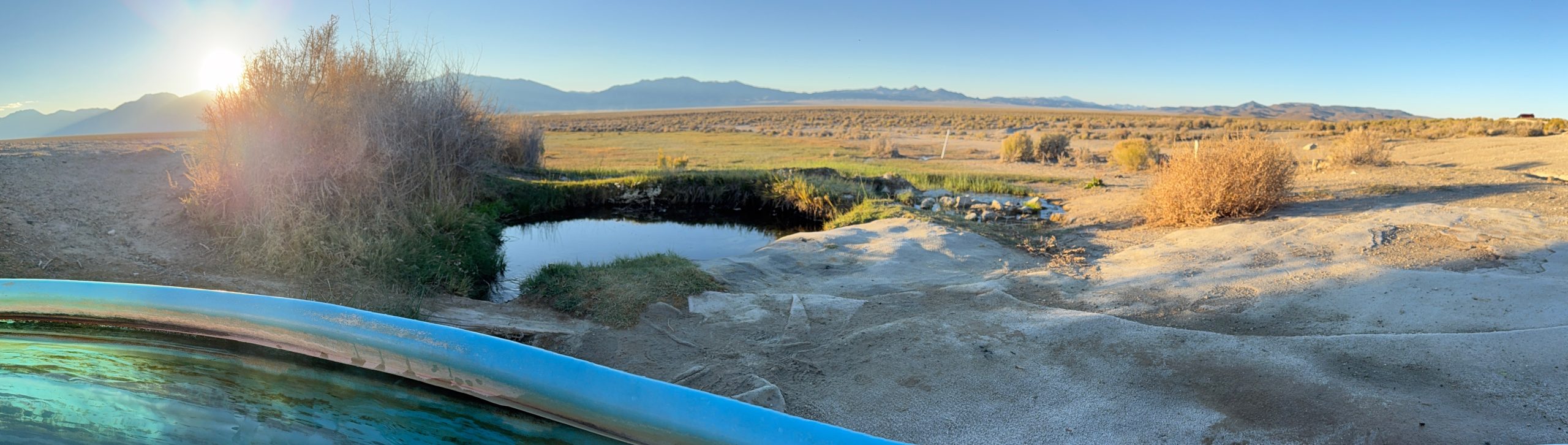
- Our evening ended with Spencer Hot Springs, where we spent the night. After setting up camp, we enjoyed the sunset while soaking in the natural springs.
Total Time with travel: 5 hours
Day 4 on the Loneliest Road – Austin to Fallon to Carson City to Lake Tahoe
This day has several optional stops. Wanting to be able to enjoy Lake Tahoe a little longer, we opted to cut some out. Regardless, you’ll want an early start this day.
- If you’re a history buff, or just like the Pony Express, you’ll want to stop at Cold Springs Pony Express Station ruins. From the turnout on the left, there’s a 2 mile hike out to well-preserved ruins. We opted out of the hike, but across the street, you can see more ruins just off the parking area.
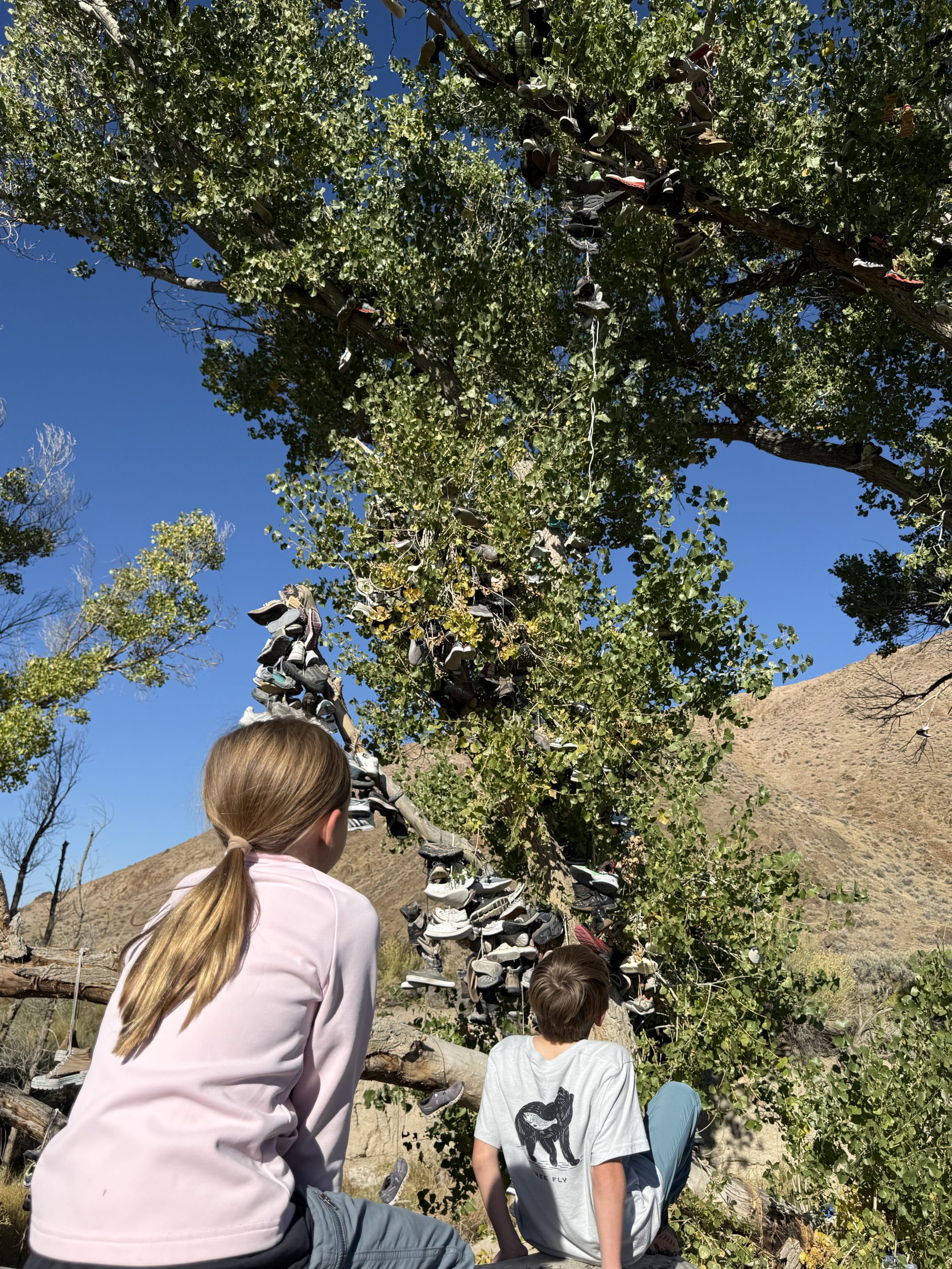
- From there, make a stop at the Middlegate Shoe Tree. Legend has it, a newlywed couple got into an argument on their way home from a Reno chapel to the extent that they pulled over on the side of the road. The wife exclaimed she would rather walk home than get back in the car, and somehow, the husband threw her shoes into a nearby cottonwood tree, daring her to try to do so. He sped off down the road to a nearby watering hole, where the friendly bartender encouraged him to go make up. He relented, they made up, and they lived happily ever after. Every year on their anniversary, they went back to throw another pair into the tree in celebration. Unfortunately, vandals cut that tree down, but in true adventurous spirit, travelers designated another tree which is now covered in shoes. We suggest bringing a pair to sacrifice to leave your mark along Highway 50.
- Just down the road, stop at Middlegate Station for food. Set in an old Pony Express station, the burgers and atmosphere are can’t miss.
- On your way into Fallon, you’ll see Sand Mountain Recreation Area. If you have an OTV, this looked like an awesome stop, but from the highway we could see all of the cars and RVs out there. Without true plans other than playing in the sand, we decided not to stop.
- In Fallon, we grabbed our survival guide stamp at the chamber of commerce and admired Maine Street before continuing west.
- If you’re hungry, I heard good things about Grid Restaurant, The Slanted Porch, and Maine Street Café.
- Our next adventure was a soak at Carson Hot Springs. This was more developed than Spencer Springs, more closely resembling pools, but the kids still loved trying out the different temperatures.
- Next door is Shoetree Brewing where we grabbed a crowler, root beer, and lemonade to go before heading to Lake Tahoe.
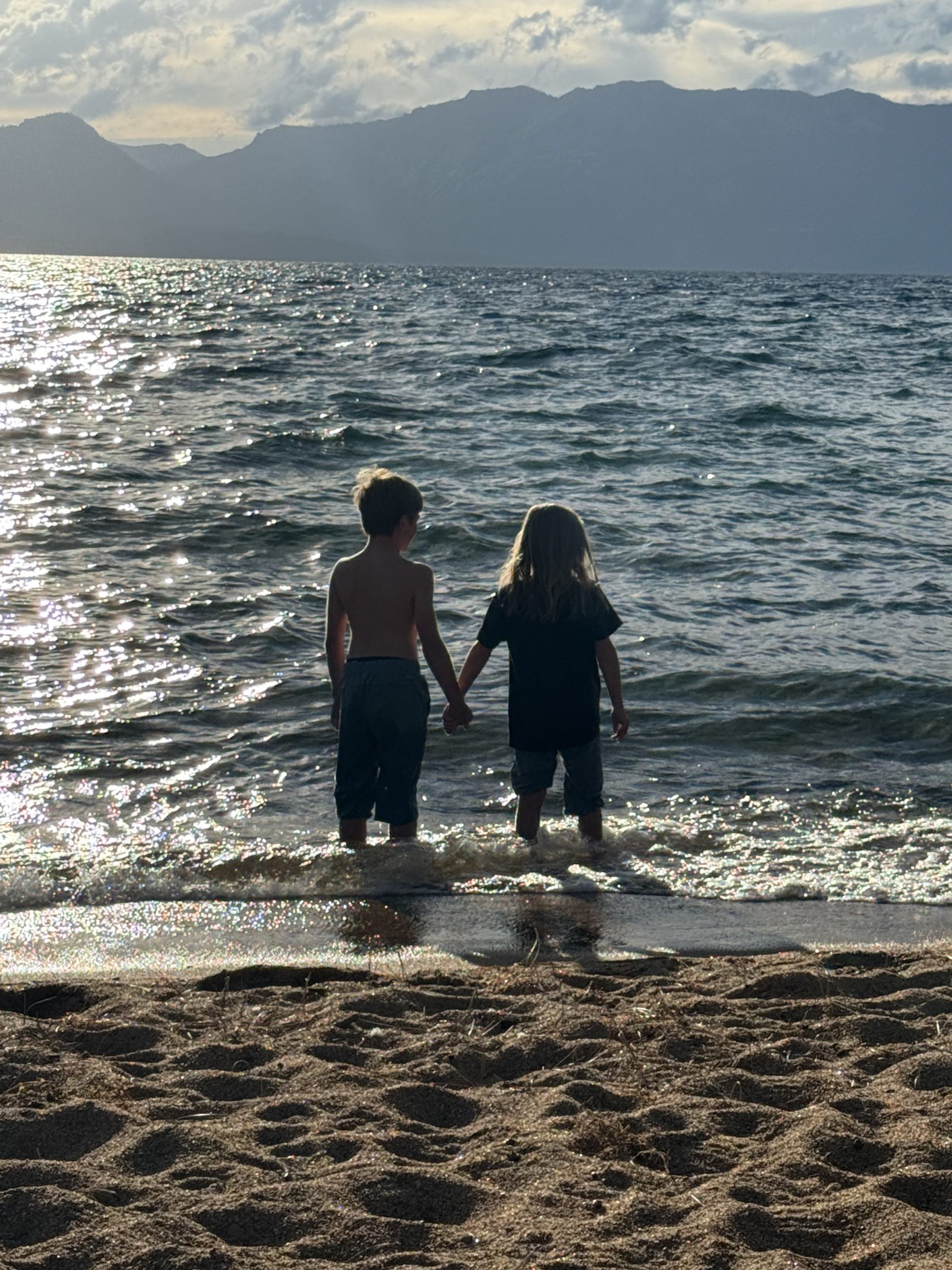
- Our night ended at Nevada Beach Campground taking in the sunset over the crystal blue waters.
Total Time with travel: variable (8 hours for us)
Ancient trees, a historic train, garnets cracked open on the side of the road, hot springs under the stars, a shoe tree with a love story, and Lake Tahoe glowing at sunset. Life Magazine can keep their warning — this road is worth every mile.
With light and love, Amber 🌿